Day 18 – Monday 13 June – Heading North
My phone advised me that it was 1 degree in Alice Springs as I headed out of the
caravan and nearly slipped on the icy step. The car windscreen needed a bucket
of water before our 8:15 departure.
After crossing over the Macdonnell ranges, we had a tail wind in
the flat plains. We soon crossed the Tropic of Capricorn and entered the
tropics.
Our first stop was at Aileron
where I took a photo of Anmatjere Man and Woman – both of whom are 17 metres
high – and both impressive.
We started to enter undulating and curving roads brought about by the rocky terrain.
Our lunch stop was at Barrow Creek, the site of another historical telegraph station and an historical pub.
We travelled 410 km for the day stopping at Bonney Well Rest Area, beside the Ghan railway track. We had hoped to stay at Devils Marbles, but there was chaos about the online booking system, and how to get appropriate internet access.
I took a photo of the Ghan track looking south. If you look very
close you can see the Ghan leaving Alice Springs, 405 km away.
The other photo shows a windmill and troughs that were connected to a well many moons ago, for watering working camels.
As Shirley cooked a chicken stir-fry we watched the sunset go,
red, red/blue, then darker. We never get tired of watching the Outback sunset.
Although there were lights from three campfires and 11 caravans, and a full
moon, the stars were also bright.
At 10:17 pm the Ghan flashed past heading north. We were surprised at how long the train was. Quite impressive. We have a friend who will be on the return trip leaving Darwin on Wednesday. She later informed us that the Ghan (this trip anyway) had 27 carriages and two locomotives.
Even later advice. The Ghan took 22 hours to travel from Darwin to
Alice Springs, including a long stop in Katherine.
Day 19 – Tuesday 14 June
– Heading Further North
What a difference a day can make. Our coldest
morning of the trip was immediately followed by the warmest.
We were on the road by 8:20 am and in Tennant
Creek soon after 9. We bought bread and diesel and an excellent coffee. We also
admired the great art-work in the main street.
Onwards we pressed as the bushes gradually got greener and more plentiful.
It was a pleasant drive enhanced by the plethora of red flowers beside the road.
We arrived at Banka Banka Station around noon and soon established camp, which was closer to the road than our free camp last night.
After lunch we walked to the lookout and took
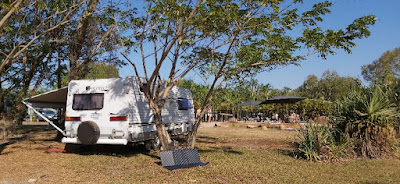
a photo of the camp. The arrow shows our rig.
It was rest time.
Today we achieved three firsts. It was the first time that shorts replaced jeans, the first time that the comfortable camping chairs came out of the car, and the first time that the caravan awning came out.
The following is my latest addition to the “interesting signs’ category.
Day 20 – Wednesday 15
June – Closer to Mataranka
We rose as the full moon set in the west and
the sun rose in the east. There was not a cloud to be seen. Shorts were donned
and the jeans went into mothballs. It was still cool enough for a windcheater,
but not for long.
I had messed up the clock in the caravan so
Shirley was up 30 minutes earlier than she thought.
In no time at all we were on the road, still
heading north. Our first stop, for coffee, was Elliot. A short time later we
had a nostalgic stop at Newcastle Waters, the location of some great bird photos in 2011. Although the water level was lower than last time I scored a couple of
photos – plus a photo of the Drovers Memorial.
Above: Jabiru (Black Necked Stork)
Bottom: Drovers Memorial Status
Our lunch stop was at the “Hi-Way Inn” near
Daly Waters, where I took a photo of a new brand of motor home – a
tongue-in-cheek adaption of the brand “Winnebago”. In case you are having trouble, the first letter is a "W".
We stopped at Larrimah for an ice-cream and checked out the Pink Panther Pub. The following items amused me.
The one on the left is obvious.
The one on the right is labelled "Spring Water"
The planned free-camp stop was rejected due
to some unseemly characters lurking there, so we booked a campsite in the Elsey
National Park, just before Mataranka. Elsey is the same Elsey as the book “We
of the Never Never”.
We established camp before we went for a walk
to the nearby Roper river. Crocs apparently use it as their home, as do
Barramundi, so we did not get too close to the water.
We BBQed some steak for dinner.
We have travelled 1105 km in 3 days and have
sat around 40 km/h under the local speed limit of 130 km/h. Needless to say a
lot of vehicles passed us as if we were standing still – including caravans.
Day 21 – Thursday 16
June – Hot Springs & Cooler Pools
Another day, another adventure. We broke camp
around 8:30 and drove a few km to the Mataranka Thermal Pool and started the
day with a hot thermal bath. It was magnificent. I felt like a new man when we
got out – but Shirley was not convinced.
With a further 100 km behind us we arrived in
Katherine in time to test the credit card. First the Tourist Information Centre
to book a pass and two tours in Kakadu (one on my birthday starting at 6:45
am). Then it was Woolworths for important provisions to last the next 5 or 6
days. Next was Brumbys for a pie for lunch. Lastly it was Caltex for diesel.
Not much change out of $300 at Caltex.
Our final drive for the day was 66 km to
Edith Falls, within the Nitmulik National Park. We squeezed the caravan onto
our site, put away the shopping and donned bathers.
The water was chillier than this morning but
much more spectacular. It was a pleasant spot to refresh ourselves – with the
chilly southern temperatures replaced by low 30’s.
Day 22 – Friday 17 June
– Douglas Daly
The start of our 4th week on the
road was a casual start as we only had 170 km to travel. We did that without a break as the potential coffee stops all fizzled out.
It is fair to say that this is quite a remote spot, but a great quiet spot for a break. No trains, no road trains, no airport.
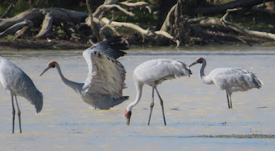
We have camp established by soon after noon and watched a Rainbow Bee-Eater as we had lunch. It is a beautiful bird.
The afternoon was all about lazing around as the temperature crept into the low 30's. However, there was a cooling breeze.
A walk was in order around 4pm so we headed off. We were advised where to find the local croc and the trap that was in place to effect its relocation. Initially, we did not see the reptile but the Douglas River views were superb.
The trap was maybe four metres long and contained the head of a black pig - complete with tusks. Not really a pretty sight. The pig was probably a wild boar that was culled from some local property.
We went for a walk and saw the offending creature. See photo below.
On the way back to camp we saw the following little guy doing gymnastics. I think he is some form of Cuckoo Shrike, maybe a juvenile Black Faced Cuckoo Shrike.
At 6pm we wandered over to the main reception/dining area and ordered two pizzas at $20 each. We only ate one and it was superb. The bottle of red was excellently priced at $20 - when you consider where we are.
We dined under the stars, in shorts, tshirts and semi-bare feet.
Day 23 – Saturday 18 June – Douglas Daly
Another beautiful day in paradise. The crocodile trap had been set off, but no crocodile inside. Maybe a good place to avoid.
A visit to the (apparently impressive) Daly river beckoned, so we headed south for a 45 km drive, half sealed and half unsealed.
While still on the sealed road we disturbed two groups of birds having an early lunch. Both the kites and the wedge tailed eagles took to the air, but I was able to get a few photos.
We did not find the Daly river thanks to a road (read very rocky narrow track) that I was not prepared to take.
However, we did come to appreciate how rich the region is in agriculture. We saw abundant evidence of hay, cotton, sandalwood and African mahogany (which I had never heard of before).
Subsequent research showed a 2020 press release advising of "an ambitious plan involving the creation of up to 50 new properties on existing cattle stations, with land identified as suitable for growing cotton, peanuts, sorghum, hay, rice and hemp - totalling over 60,000 hectares". This is apparently on top of the huge volumes of wood plantations and cotton.
The afternoon was spent chilling out - as you do.
Day 24 – Sunday 19 June
– Litchfield NP (or not)
Today was not one of my better days. Firstly,
we left the Douglas Daly park around 9:30 then headed back to the Stuart
Highway.
Around 35 km later was mistake number one.
The GPS said turn right. My finely tuned razor sharp navigating mind said turn
left, as the GPS had it wrong.
Wrong. The GPS had it right. It wanted me to
go in the shorter, smoother & wider road. I took us on a longer rougher
& more twister route. But it was more scenic.
Anyway, we re-joined the Stuart Highway at
Adelaide River and Shirley saw a sign that said “market today”. She was
impressed – until she saw that the market had three stalls. So, on we pressed, after having a coffee and realising that the above road had caused the top to come off the mustard. Hmmmmm. It was 3 days before I realised that 2 stubbies of beer has also been adversely affected by the above road.
We drove through Bachelor and soon we were in
Litchfield National Park. First stop was the magnetic termite mounds – so
called because they are skinny and the narrow edges all face north or south.
Some mounds were pretty big, as shown by the photo with Shirley below.
About 40 minutes later near 12:30 we arrived at our campsite for three days – to get a rude surprise.
Mistake No 2. You need to pre-book NP sites
online, which I had done some days ago. All paperwork was correct and in hand.
The only issue was that I had booked a camp-site reserved for groups camping in
tents. No caravans were allowed, and we were not able to get passed the cable
fence.
There was no internet service within 70 km to
find another site. So, on we drove. Not really happy by this stage.
At the northern end of Litchfield NP we found
a caravan park with unpowered sites available. So we pitched camp around 25
metres from the swimming pool, and 100 metres from the licensed bar & restaurant.
We had a coffee and a swim and relaxed – for a mental and physical cool-down.
The sunset was not spectacular but the sky 30 minutes later was a sight for sore eyes.
Day wrap. A couple of hick-ups. The (eventual) camp site is great. The pool superb. While in the pool we met some lovely people from Port Fairy and Tamworth. The post-sunset view excellent. We will have to do a few extra km than planned. So what?
Day 25 – Monday 20 June
– Litchfield NP
Yesterday was a day to forget.
Today was a day that we never want to forget.
We headed back to Litchfield NP at 8:30 and
arrived back at camp around 4:30. It was a non-stop day of enjoyment and
sightseeing, culminating in a (negative) breathalyser test on the way home.
We started at Tolmer Falls with a
three km walk and some great waterfalls views. On the way we also saw some
local fauna and flora.
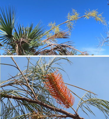
The coloured flora
consisted mainly of the Turkey Bush, the Native Hibiscus the numerous Cycads
and the Wattle.
Our next destination was via a narrow 4WD
track to a place called the Lost City, so called because it resembles
what an ancient civilisation may have built. [You need to have an imagination
here] The rock formations were impressive.
We had a coffee via a thermos and were
surprised by the number of people who were disappointed that they could not
have a coffee.
After that we headed to Buley Rockhole. A
quick look and bathers were donned and the water entered – remembering that it
was touching 30 degrees out of the water. It was a very pretty spot to bathe.
Next on the schedule was lunch before the walk into Florence Falls, which involved over 150 steps either way. However, it was worth it. The twin falls were magnificent.
Into the water, again, we went and I swam across to underneath the falls. There were heaps of people in the water, of all ages. The water was teaming with fish, which we think were Black Bream.
Our last stop was Wangi Falls, where we
should have been camped. Again there were (at least) twin falls and just as
impressive as earlier sightings. There were also 100+ steps either way.
On our walk we were able to see some butterflies
who seemed to be either having a party or engaged on some form of mating ritual.
I really did like the following sign and wondered which way people would go to Darwin, particularly tourists who are new to both roads.
By the way the sensible way to go, in most cases, would be 145 km via Berry Springs.
On the way back to camp we slowed down to get
a photo of some indigenous undergrowth management with controlled fire. With all of the fires around Litchfield it was not the best day for photos - but we managed.
I cooked bangers and mash and vegies for dinner. Immediately after dinner I jumped into the pool to cool off.
It was another good night for sleeping.
Day 26 – Tuesday 21 June – Berry Springs
As yesterday was such a busy day we started casually - with eggs & tomatoes cooked on the BBQ. Then a bit of lazing until we decided on a walk around the park. They have an enclosure with seven fresh water crocs in residence, one being happy to pose for us.
The café beckoned where they had a special on coffee & scones (pumpkin & plain). So we did.
Lunch was prepared, put on ice, then we grabbed our bathers and departed.
Berry Springs Nature Park is 11 km up the road. We were soon there, no thanks to Google Maps. It was wrong this time.
There are virtually two entries to the thermal pools, joined by a channel, shown in order below. The first photo shows the falls where the water enters the 'upper' pool, then the 'channel' that connects the upper pool to the 'main' pool.
We had a soak in the main pool - virtually all of it over our heads in depth. Of course we had the obligatory $5 pool noodles, as does 2 out of 3 people.
Then we had a soak in the 'upper' pool. The water pressure under the (seemingly small) falls was amazing.
We celebrated with a locally-made mango ice-cream. It was superb.
Back at camp we did a few little jobs ready to depart tomorrow - before another dip in the pool.
Day 27 – Wednesday 22
June – Dundee Beach
It was a casual start to the day, and we
broke camp around 9am. As has been the trend I missed the turn off (blamed it
on the lack of internet service) and we checked out Waiget Beach and Mandorah
first. There was not much at either.
There is a ferry from Mandorah to Darwin and
we could see Darwin across the water – partially hidden behind the smoke haze.
It takes 20 minutes for the ferry to cross.
Below: View of Darwin from Mandorah
We
retraced our steps and ended up at Dundee Beach. On the way we enjoyed seeing
many flowering bushes, despite the recent burn off.
We
returned to have lunch and watch a pair of “Little Corellas” prune a tree.
It
was hot and windy so we relaxed.
Around
5:30 we wandered down to the beach and played ‘hide & seek’ with (I think
is) a “Black Kite”. He/she was a magnificent creature.
We wandered along the beach, which was more rocks than beach. We could not go near the water, thanks to a range of creatures – large & small – who could cause us grievous harm.
We took the opportunity to buy a drink at the pub and sit at a table on the lawn.
Eventually the sun set, and we were happy.
Shirley decided on spaghetti bolognaise. I decided on my first attempt at damper in the microwave. Seems like sacrilege, does it not – damper in a microwave? I overcooked it. It tasted great but was the texture of a crispy ginger nut. I will learn from that.
Day 28 – Thursday 23
June – Dundee Beach
Sulphur crested cockatoos decreed the start
to the day, about 20 minutes before sunrise, and about 90 minutes before
Shirley-rise.
Our hardest decision of the morning was to
decide whether to go for a drive or have a coffee first. The drive won.
We tried to find more beach and soon came to
the decision that this part of the coast is more about rocks than sand. We were
fascinated by the colour of the rocks. If only I were a geologist.
In a remote spot we found the ‘Dundee War Memorial’, overlooking the Indian ocean. There was not a building within cooee. Even the road to it was unsealed.
We returned and stopped at the pub for a coffee, so that we could do some internet ‘stuff’ like paying bills. I may have to go back this afternoon to do some more ‘stuff’.
We
had lunch, a swim, some travel planning – and I returned to the pub to do some
travel bookings.
After that I sat and watched some Corellas do their ‘thing’. I do not know if it was a feeding ritual or a mating ritual, or some other exercise, but the threesome seemed to be pretty animated. There are a number of photos involved.
If you are
a bird person please click here. If not, just read on.
We had a BBQ for dinner.
Day 29 – Friday 24 June
– Dundee Beach & Beyond
Another lovely start to an NT day.
Shirley
wanted to find a nearby camping spot that she found out about from other people
in the pool yesterday. We found a narrow track and followed it and found a nice
beach and an isolated camping spot.
Shirley
also wanted to see a place called “Crab Claw Resort”, about 50 km away. So off
we headed. She did not tell me that 20 km of it was a rough corrugated dirt
road. We were disappointed with Crab Claw Resort. Maybe a good spot if you are
a keen fisherman. But otherwise ………..
On
the way back to camp we stopped at a road-side stall and bought eggs, pumpkin
and cucumbers. The lady on site was a wealth of knowledge on houses-on-stilts
and nearby wet and dry lands.
Chicken stir-fry for dinner.
Last updated at 8:30 am (NT Time) on Sunday 264 June.
This chapter is complete.
-----------------------------------------------------------------------------
Maps for Chapter 4
1. Alice Springs to Darwin
2. Mataranka to Darwin


😃 Thanks Chris.
ReplyDelete